Map reproduced by permission of Ordnance Survey ® on behalf of the Controller of Her Majesty's Stationery Office. © Crown copyright. All rights reserved. License number 100044910.
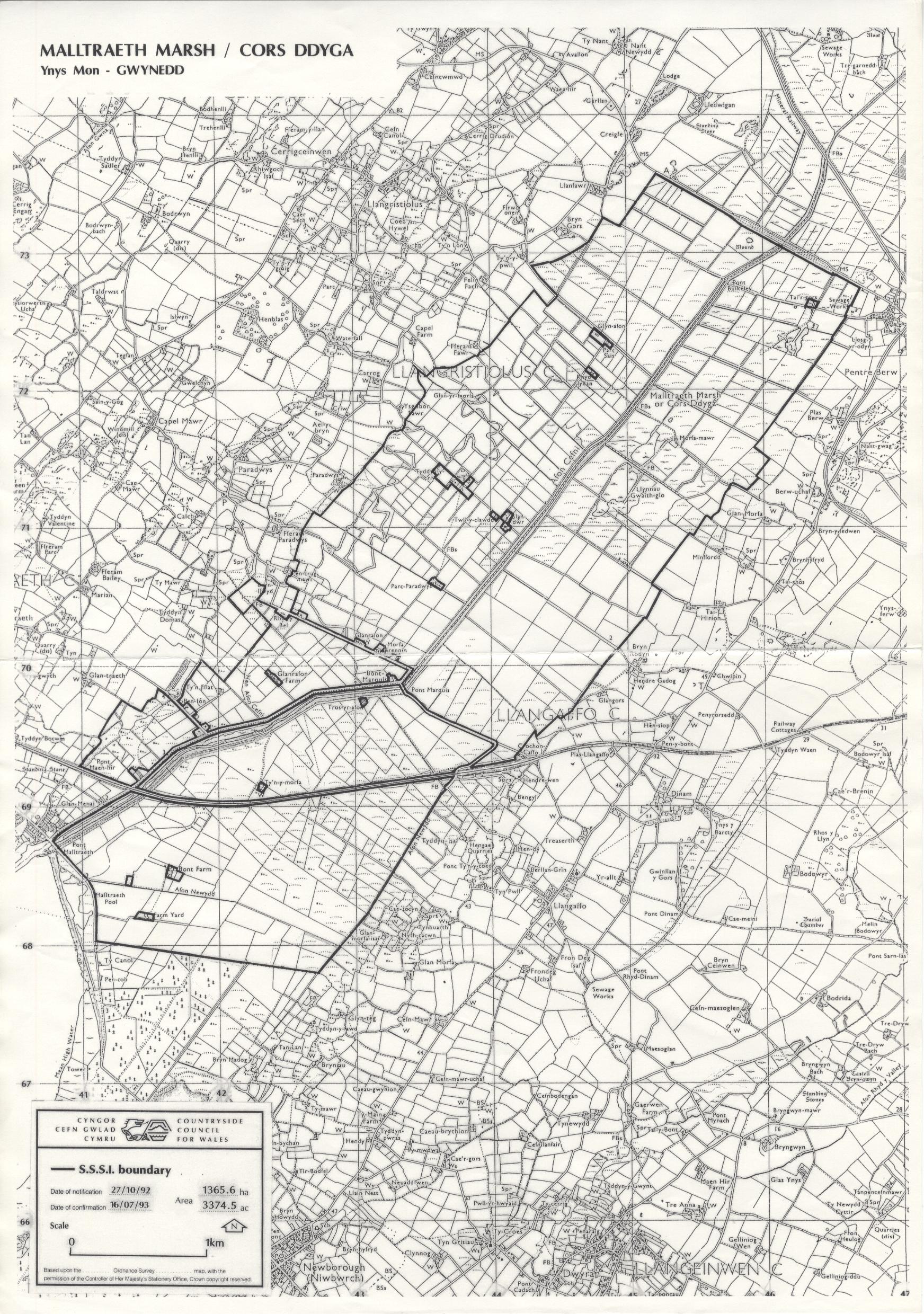
This large grazing marsh was reclaimed from estuarine marshes following the contruction of the embankment of Malltraeth Cob and the canalisation of the Afon Cefni after 1824. The former salt-marsh creeks are still visible on aerial photography and evident as shallow depressions in the fields. Coal mining occurred for a time in the underlying carboniferous deposits and the subsidence of these workings resulted in the lakes "Llynnau Gwaith-glo". The original drainage system comprised clay-lined ditches to carry water from higher land across the marsh to the parallel Afon Cefni main drains which then discharged through the floodbanks into the Cefni. Water levels were lowered in winter but apparently "penned" in summer to maintain irrigation of the fields and water for livestock. This system appears to have been destroyed with the post-war introduction of heavy drainage machinery and conseqential lowering of summer wter levels. This, and drastic increases in stocking levels have lead to a decimation of the area's ground nesting birds such as lapwing, snipe, redshank and curlew. A large RSPB reserve has been established at the eastern end of the site to create large areas of reedbed, wet pasture and open water.
Potentially Damaging Operations list
Map reproduced by permission of Ordnance Survey ® on behalf of the Controller of Her Majesty's Stationery Office. © Crown copyright. All rights reserved. License number 100044910.