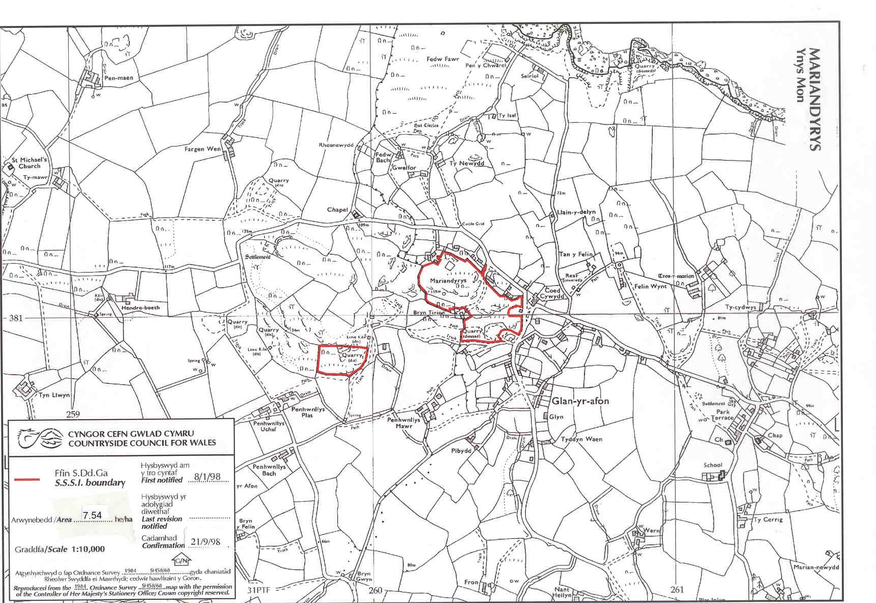
Limestone grassland and calcareous heath occur on this outcrop of the Penmon limestone. Most of the site (the larger eastern section) is a North Wales Wildlife Trust Reserve and common land and there is open public access to this area. The western section is private.
Anglesey mapPotentially Damaging Operations list