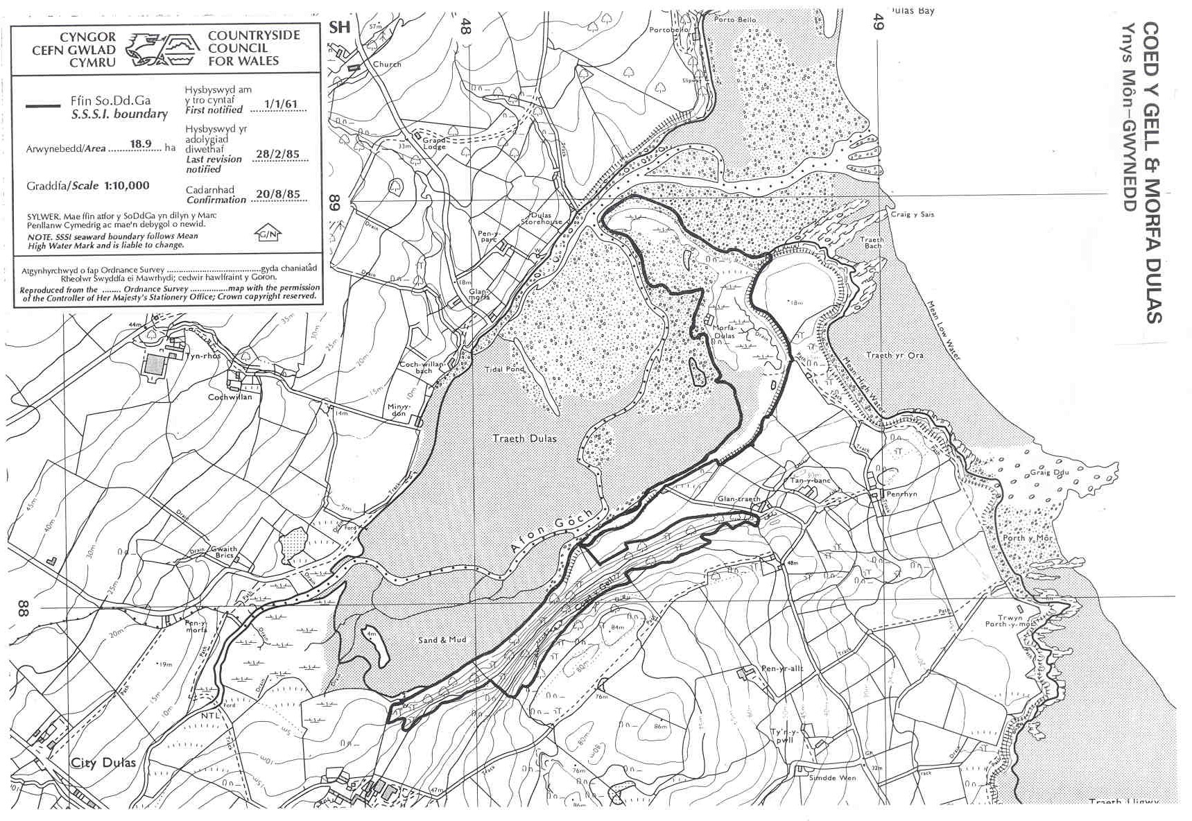
COED Y GELL AND MORFA DULAS SSSI
This small, north facing coastal
oak-ash woodland on the outcrop of old red sandstone has a well
developed understory of hazel elder an spindle and supports a number
of unusual mosses. Unusually it comes down to the shore and abuts
saltmarsh and mudflats. Traeth Dulas receives copper polluted waters
from Mynydd Parys
and the estuarine sediments are heavily contaminated. The sandy spit at
the mouth of the estuary used to support a little tern colony before
disturbance from walkers and ground predators eradicated them from
northwest Wales by the mid 1980s.
Anglesey map
SSSI Citation
Potentially damaging Operations list
Vertical Aerial Photograph
Map reproduced by permission of
Ordnance Survey ® on behalf of the Controller of Her Majesty's
Stationery Office. © Crown copyright. All rights reserved. License
number 100044910.